The intelligence layerfor CCS.

EXPLORE THE PLATFORM

01

MAP THE MARKET

Explore emitters, capture projects and infrastructure in one connected global view.
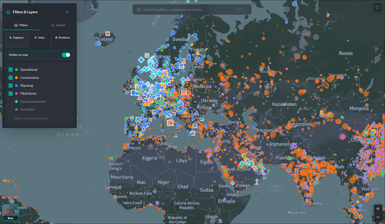
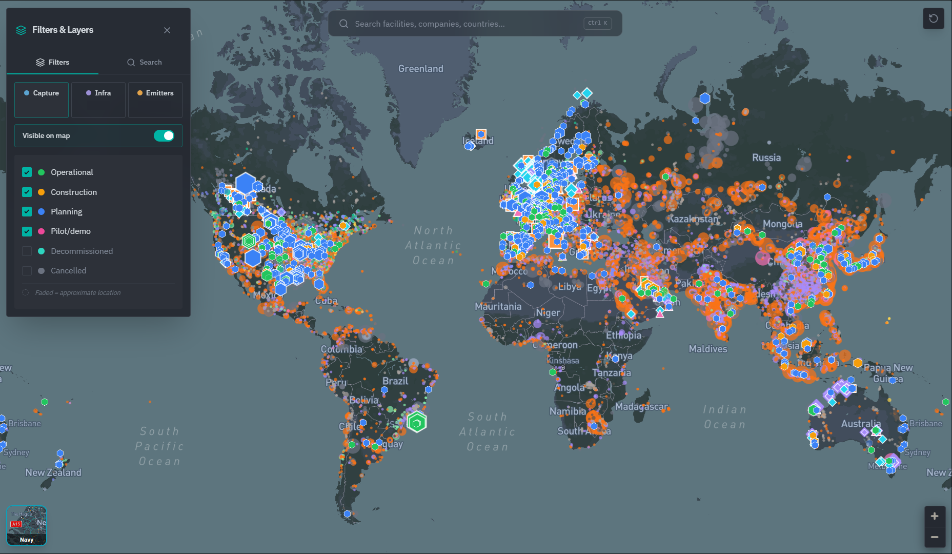
Global CCS Map showing capture, infrastructure and emitter layers with filters.
02

COMPARE THE ROUTE

Screen source-to-sink alternatives across transport modes, terminals and storage.
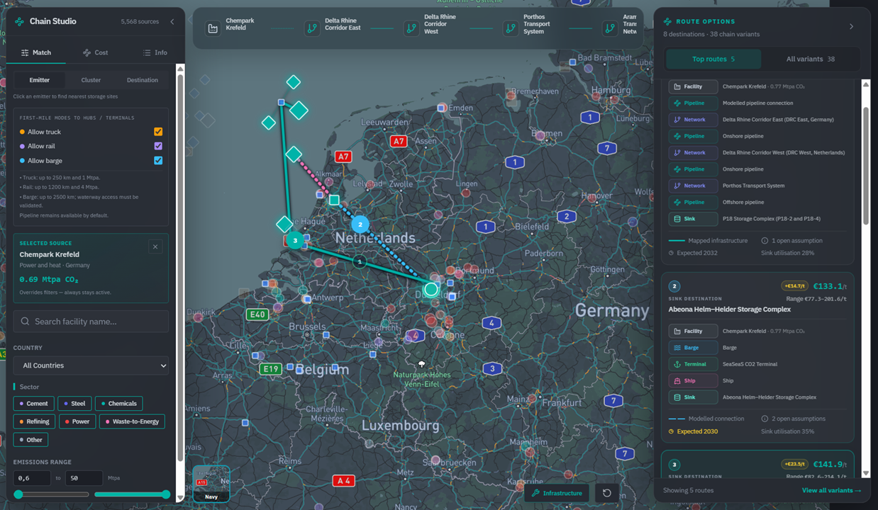
Chain Studio comparing multimodal CO₂ transport routes and indicative costs.
03

TRACK WHAT IS MOVING

Follow project status, timing, partners and development signals.
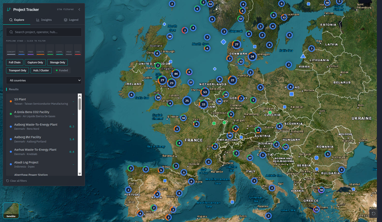
CCS Project Tracker showing pipeline stages and filtered project results across Europe.
04

UNDERSTAND THE INFRASTRUCTURE

Review corridors, mapped routes, infrastructure records and storage connections.
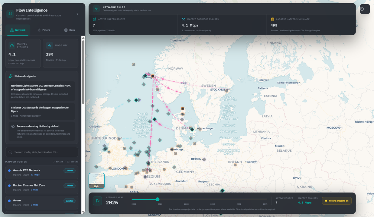
Flow Intelligence showing mapped corridors and a selected storage infrastructure record.

INTERACTIVE PLATFORM

Explore CarbonMap Yourself.

Move through the CCS market directly.

carbonmap.nl/global25,000+ emitters
Global CCS coverage
Global CCS index · 2026

Three flagship modules,one connected workflow.

Chain Studio
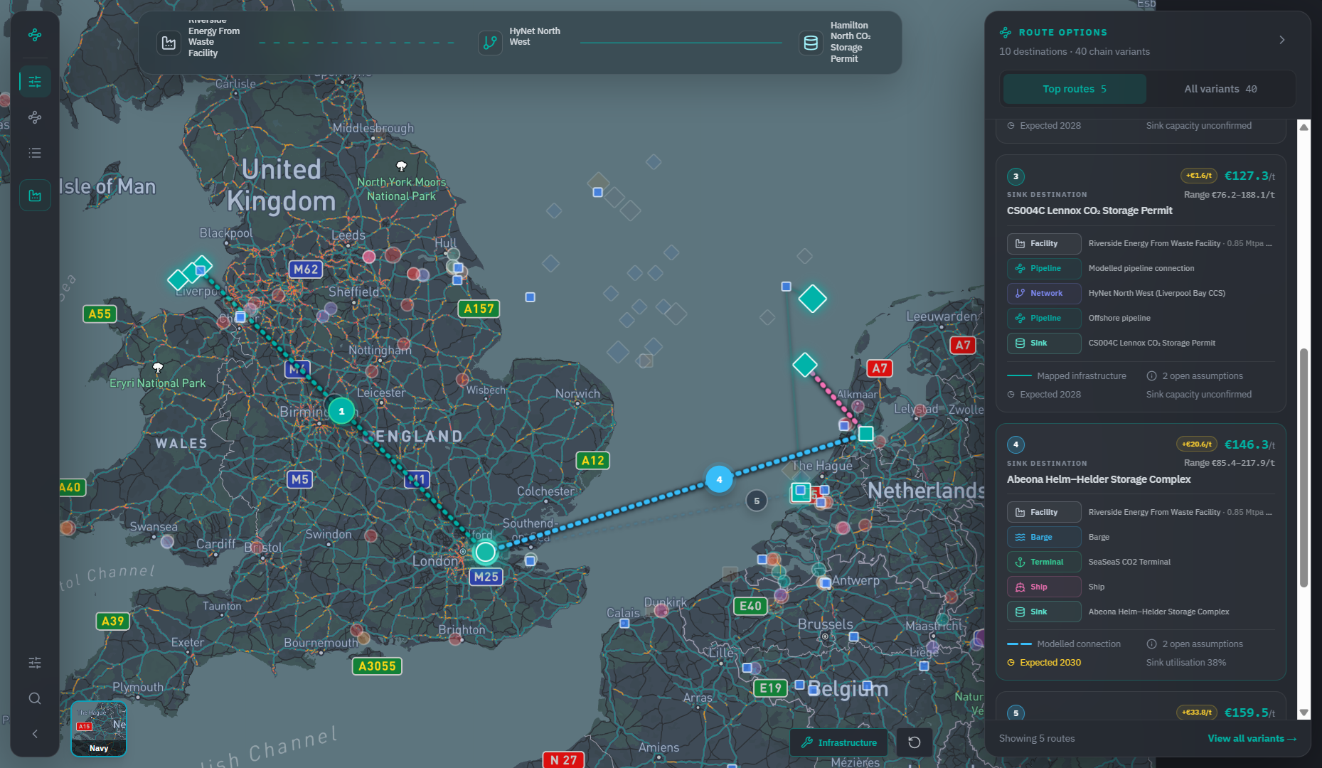
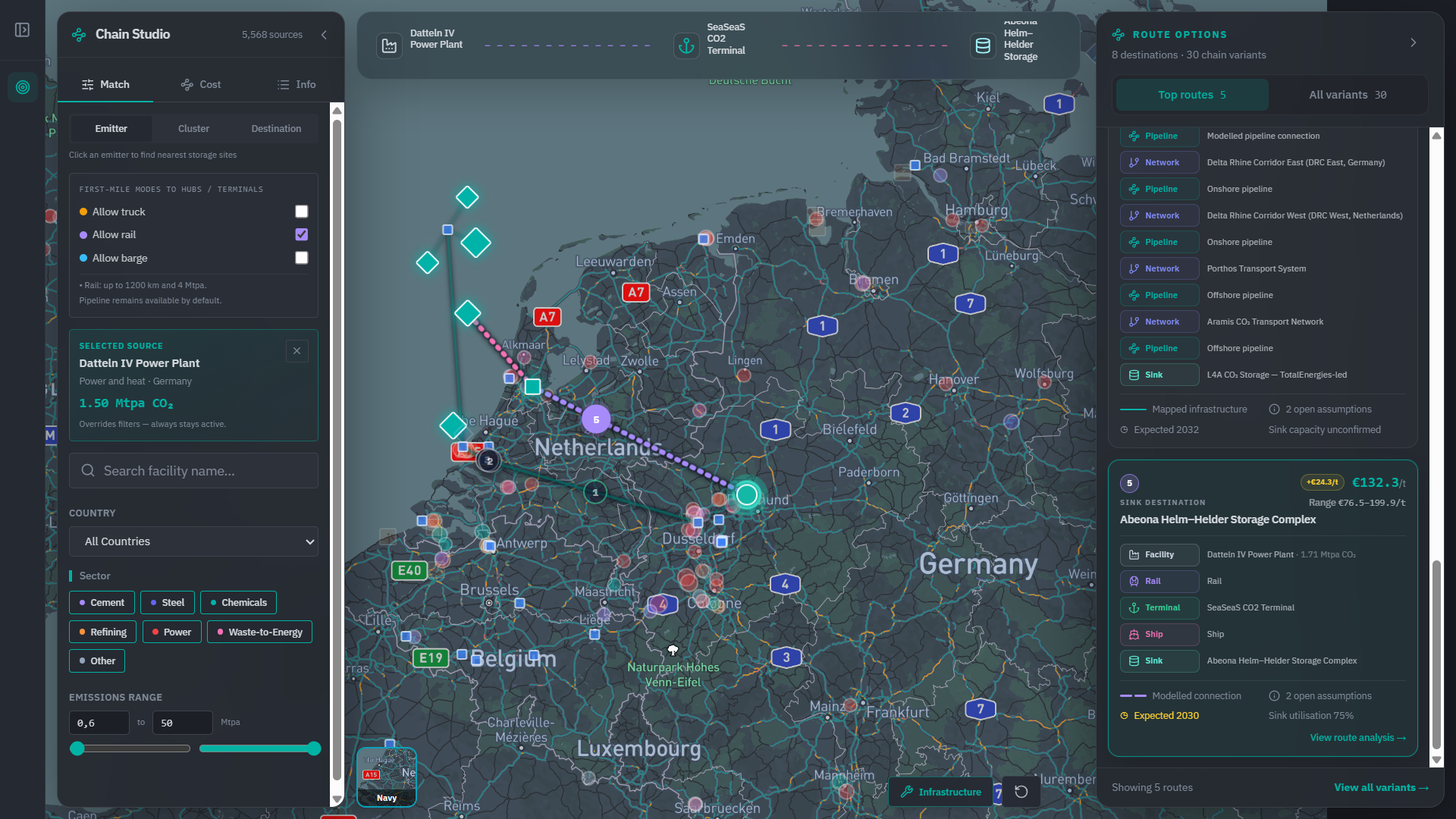
Chain Studio screen showing a selected emitter, a multimodal transport chain and ranked route options with an indicative cost per tonne.

From source to sink — ranked, costed and explainable.

Compare potential CCS chains across pipeline, rail, barge, ship, terminals and storage. Review route alternatives, indicative cost ranges, key assumptions and storage fit in one workflow.

  • Emitter selection with volume and sector context
  • Multimodal settings: pipeline, rail, barge, ship
  • Selected route plus ranked alternatives
  • Indicative EUR/t range with open assumptions
  • Storage destination and chain fit

GLOBAL COVERAGE

Global coverage.One connected model.

Explore CCS activity across Europe, the Middle East, Asia-Pacific and the Americas without rebuilding the market view for every region.
25,000+
EmittersVolumes, sector and location context
1,200+
Capture projectsStatus, timing and announced capacity
350+
Infrastructure assetsTerminals, corridors and storage complexes
Global CCS coverage map showing emitters, capture projects and infrastructure across regions.
25,000+ emitters · 1,200+ capture projects · 350+ infrastructure assets

The chain

Intelligence at every pointof the source-to-sink chain.

Dense corridors, highest throughput, fixed routing.

  1. SOURCEIndustrial and energy emitters with volumes and sector context.
    VolumeSectorCapture readiness
  2. CAPTURECapture projects, status and announced capacity.
    Project statusTimingCapacity
  3. TRANSPORTPipeline, rail, barge and ship legs with distance limits.
    PipelineModalityDistanceCorridor fit
  4. HUBTerminals, aggregation points and corridor connections.
    Terminal accessAggregation logicThroughput
  5. SINKStorage complexes, capacity signals and utilisation.
    CapacityTimingUtilisationFit

TRUST & METHODOLOGY

Built for screening.Designed for scrutiny.

CarbonMap is a decision-support and screening platform. It does not replace project-specific engineering, vendor quotations or technical due diligence.

01

Source-linked records

Project information is designed to remain traceable to its underlying source.

Source references are retained with project records

02

Transparent assumptions

Route logic and screening assumptions should be visible and understandable.

Route and cost assumptions are exposed in the workflow

03

Ranges, not false precision

Indicative economics are presented as screening ranges, not vendor quotations.

Cost shown as an EUR/t range

04

User-controlled scenarios

Teams can compare alternatives and adjust relevant scenario inputs.

Scenario inputs are editable
Chain Studio evidence view showing source-linked assumptions, cost ranges and scenario controls.
Evidence — sources, assumptions and EUR/t ranges in the product

CO-OPERATION IN PRACTICE

CO-OPERATION PARTNER
duisport logo

CarbonMap and duisport have explored how emitter intelligence, transport modalities and source-to-sink screening can support the development of CO₂ aggregation concepts.

Multimodal CO₂ aggregationand hinterland value-chain screening.

Hinterland scope
Emitters within reach of the Duisburg node
Modalities screened
Rail and barge to seaport terminals
Question addressed
Where does inland aggregation change route economics?
Corridor analysis view showing inland CO₂ aggregation routes toward seaport terminals.
Hinterland corridor screening view

Use cases

Built for the teams shaping the CCS chain.

01

Infrastructure & storage developers

Screen emitter opportunities, corridor logic and storage fit before committing detailed development work.

  • Which emitters are within reach of this corridor?
  • Where does aggregation change the economics?
  • Which storage destinations fit this volume profile?
02

Industrial & market intelligence teams

Understand available infrastructure, project maturity, route alternatives and indicative chain economics.

  • Which transport and storage options are becoming available?
  • How do source-to-sink alternatives compare?
  • Which projects are progressing toward operation?
03

Engineering & advisory

Structure early-stage screening and focus detailed client work on the most relevant options.

  • Which options should be screened first?
  • Where is detailed engineering most valuable?
  • Which market and infrastructure assumptions need validation?

Map the route.Screen the economics.Decide what to pursue.

Explore CarbonMap with your own CCS use case.

Prefer a guided walkthrough? Book a 30-min call.